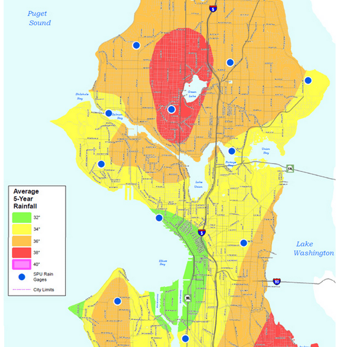
Seattle Rain Map
 There's a fascinating article over at Komo News that uses Seattle Public Utilities data to map Seattle's rain patterns, Rainier Beach really is rainier than anywhere else in Seattle:
The Seattle Public Utilities, which operates 17 rain gauges spread across the city, has gone back over their past 35 years of data and have discovered Seattle's rains are not equal. Some parts of the city get as much as 20 percent more rain per year on average than others. SPU has used this data to declare the wettest spot in the city: The Rainier Beach neighborhood.I'm glad to see I live in a neighborhood that "only" sees 34" of rain as opposed to 40"!
More like this
”
Getting Creative: Seller Financing & Assumable Mortgages in Seattle
Looking for a lower rate than you can get through a conventional lender? The most common strategy is to have the seller pay for a 3-2-1 or 2-1 rate buy-down. But what about some uncommon, more creative strategies? This is where seller financing or an assumable mortgage come in. List of Seattle-area Seller Financing Homes […]
Matt Goyer
November 15, 2022
”
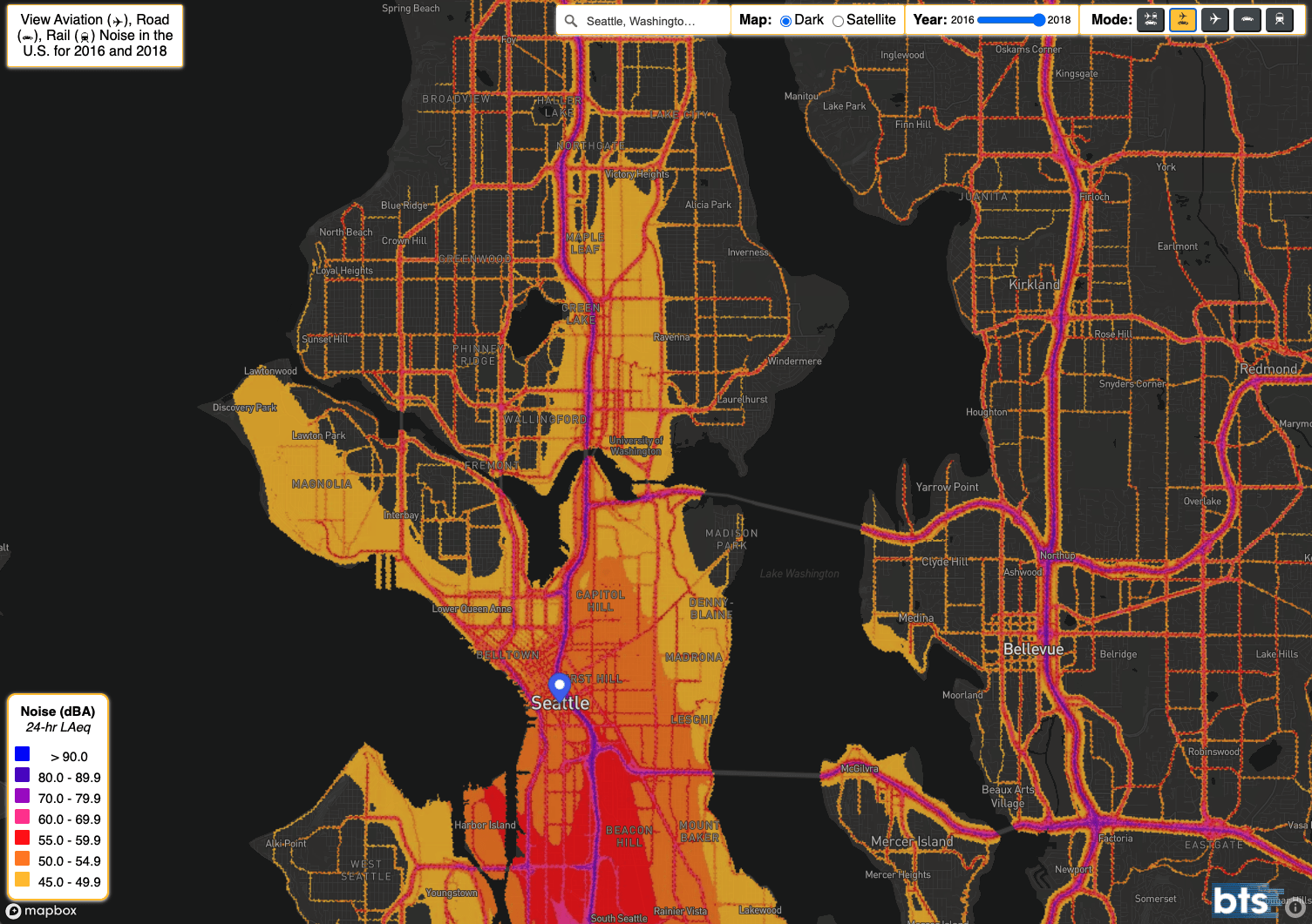
Seattle noise map
Looking for some peace and quiet in Seattle? Check out the National Transportation Noise Map from 2018 that shows the impact planes and cars have on noise levels. For peace and quiet looks like you want to head to West Seattle, or to the north-west or north-east.
Matt Goyer
February 23, 2021
”
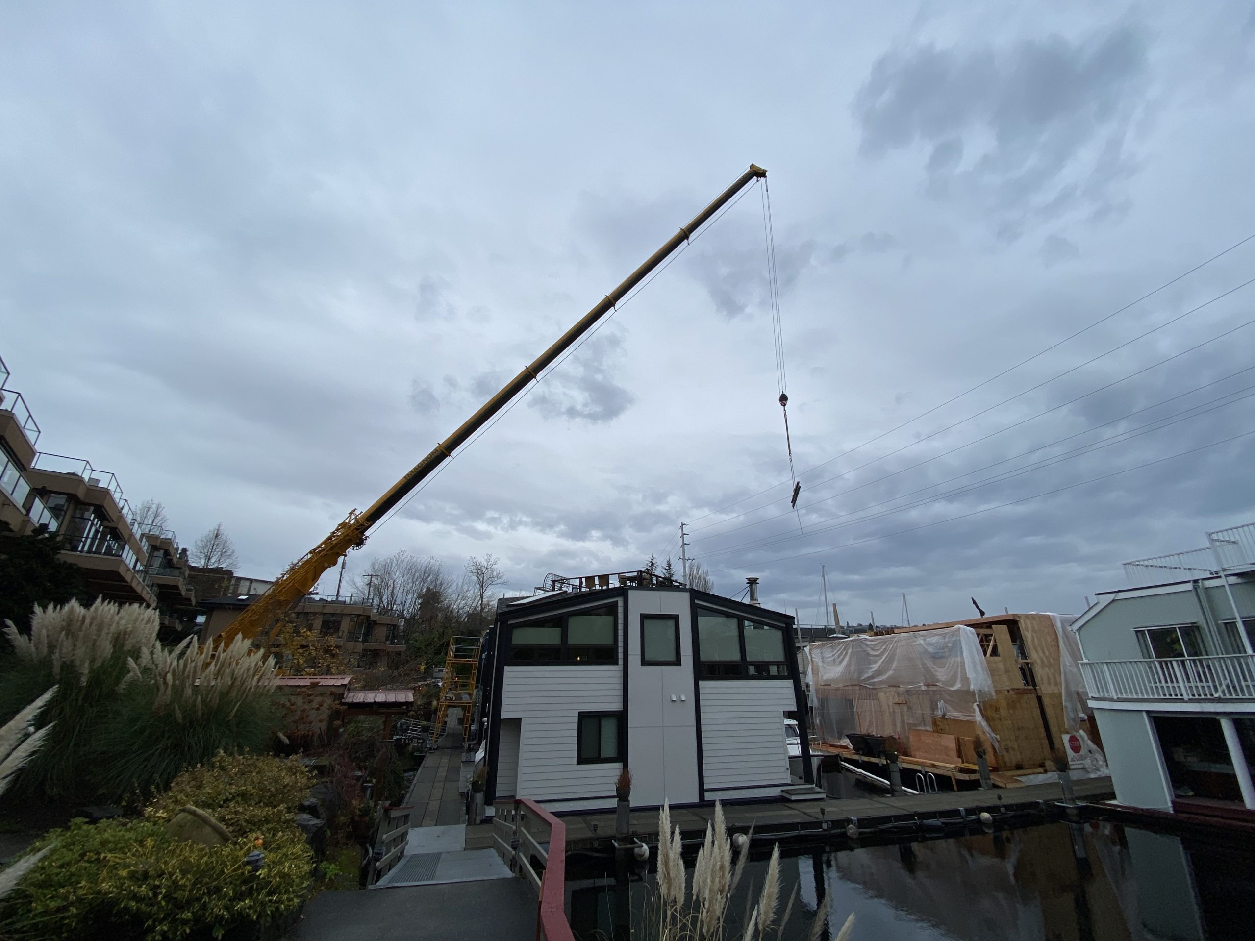
#11 floating home remodel – i-beam craned in
We’re two and half months into remodeling our floating home for a second and final time. More on the whole remodel later, but here’s a look at likely the most interesting part of the whole project – craning a 34′ i-beam overtop of our neighbor’s homes and dropping it into the second story of our […]
Matt Goyer
November 23, 2020